Tag: p3sdlp

NCICD hoped to create solutions, not more problems

Jakarta Bay

JAKARTA, KOMPAS — The National Capital Integrated Coastal Development (NCICD) project, which is currently integrated with the reclamation project of 17 islands on Jakarta Bay, was created to provide solutions for a number of problems in the capital city, including land subsidence and flash floods. However, until now, some of these problems have only been handled partially.
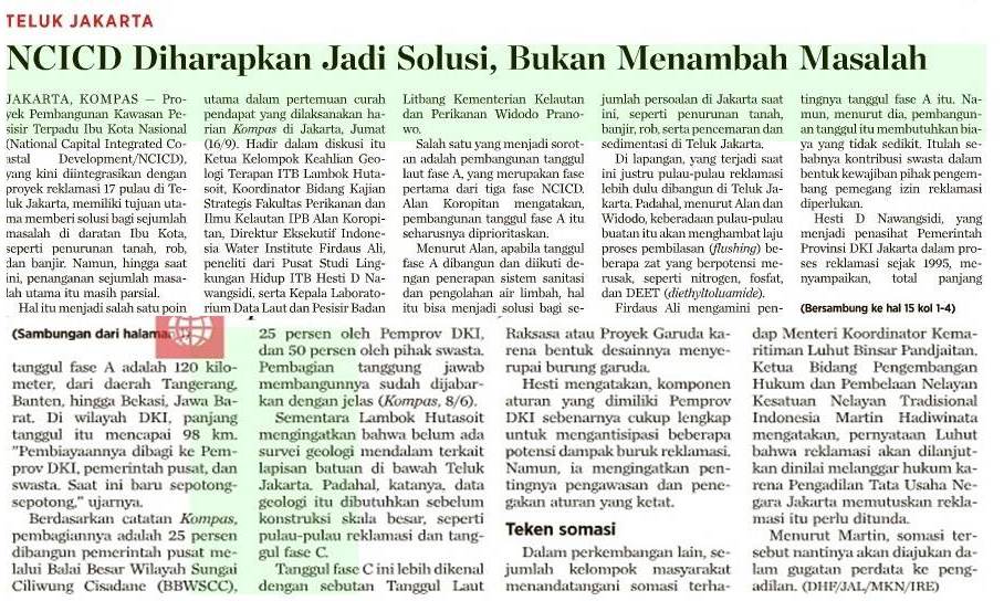
The Coast and Sea Data Laboratory Head of the Marine and Fisheries Ministry's Research and Development Body, Dr. Widodo Pranowo, gives a presentation as part of a brainstorm event on the Jakarta Bay reclamation at the Kompas newspaper office in Jakarta on Sept.16. Also in attendance were Bandung Institute of Technology (ITB) Environment Study Center Researcher Hesti D Nawangsidi, ITB Applied Geology Expertise Group Head Prof. Dr. Ir. Lambok Hutsoit MSc, Bogor Institute of Agriculture Fisheries and Marine Science Faculty's Strategic Study Coordinator Alan F Koropitan PhD and Environmental Engineering researcher and lecturer at University of Indonesia Faculty of Engineering's Civil Engineering Department and Indonesia Water Institute Executive Director, Dr. Firdaus Ali. [Kompas/LUCKY PRANSISKA]
The Coast and Sea Data Laboratory Head of the Marine and Fisheries Ministry’s Research and Development Body, Dr. Widodo Pranowo, gives a presentation as part of a brainstorm event on the Jakarta Bay reclamation at the Kompas newspaper office in Jakarta on Sept.16. Also in attendance were Bandung Institute of Technology (ITB) Environment Study Center Researcher Hesti D Nawangsidi, ITB Applied Geology Expertise Group Head Prof. Dr. Ir. Lambok Hutsoit MSc, Bogor Institute of Agriculture Fisheries and Marine Science Faculty’s Strategic Study Coordinator Alan F Koropitan PhD and Environmental Engineering researcher and lecturer at University of Indonesia Faculty of Engineering’s Civil Engineering Department and Indonesia Water Institute Executive Director, Dr. Firdaus Ali. [Kompas/LUCKY PRANSISKA]

This was one of the major points of the discussion held by Kompas in Jakarta on Friday (16/9/2016). Attending the discussion were Bandung Institute of Technology (ITB) applied geology research group head Lambok Hutasoit, Bogor Agricultural Institute (IPB) fisheries and maritime sciences faculty strategic research coordinator Alan Koropitan, Indonesia Water Institute executive director Firdaus Ali, ITB center for environmental studies researcher Hesti D Nawangsidi and Maritime Affairs and Fisheries Ministry marine and coastal data laboratory head Widodo Pranowo.

One highlight in the discussion was the construction of Phase A of the sea wall, which was the first of NCICD’s three phases. Alan Koropitan said that the construction project should be prioritized. According to Alan, the construction of the project and the implementation of sanitation and wastewater management systems can provide solutions for a number of problems in Jakarta, including land subsidence, flash floods and pollution and sedimentation in Jakarta Bay.

In the field, the reclamation islands’ construction is prioritized in Jakarta Bay, whereas Alan and Widodo said that the man-made islands would obstruct the flushing process of a number of potentially damaging chemical substances, including nitrogen, phosphate and DEET (diethyltoluamide).

Firdaus Ali agreed with the importance of the Phase A construction of the sea wall. However, he said that the construction project needed a huge amount of money. This is why private sector contribution in the form of social responsibility projects by the developers holding reclamation licenses is necessary.

Hesti D Nawangsidi, who has advised the Jakarta administration in the reclamation process since 1995, said that the total length of the Phase A sea wall was 120 kilometers, stretching from Tangerang in Banten to Bekasi in West Java. In Jakarta waters, the sea wall would be 98 kilometers long. “The financing is split between the Jakarta administration, the central government and private entities. Currently, the progress is partial,” she said.

Kompas reports show that 25 percent of the project is constructed by the central government through the Ciliwung-Cisadane Flood Control Office (BBWSCC), another 25 percent by the Jakarta administration and the remaining 50 percent by private companies. This share of responsibilities has been detailed clearly (Kompas, 8/6/2016).

Koran Kompas Cetak, 17 September 2016

La Nina Datang Tuna Pun Melimpah

Majalah Sains Indonesia

Jakarta, Rubrik, 28 Juni 2016

“Fenomena La Nina memicu curah hujan tinggi dan gelombang setinggi 4-6 meter. Masuknya air hangat dari perairan Pasifik Barat ke perairan Nusantara, membawa serta populasi tuna maupun pelagis besar lainnya dalam jumlah banyak”.

Badan Nasional Penanggulangan Bencana (BNPB) menyebut fenomena La Nina pada musim kemarau tahun ini, memicu curah hujan tinggi dan gelombang setinggi 4-6 meter. Namun, La Nina juga mendorong masuknya air hangat dari perairan Pasifik Barat ke perairan Nusantara, disertai migrasi ikan tuna maupun pelagis besar lainnya dalam jumlah banyak.

Badan Meteorologi, Klimatologi, dan Geofisika (BMKG) mengingatkan para pengguna transportasi laut agar berhati-hati terhadap gelombang tinggi dan arus laut yang kuat di sejumlah perairan di Indonesia. Tahun ini diperkirakan ada 1,6 juta pemudik yang menggunakan angkutan laut. Masyarakat yang berwisata ke pantai juga diminta waspada terlebih fasilitas keamanan pantai masih minim.

Deputi Bidang Meteorologi BMKG, Yunus S Swarinoto, mengatakan, tingginya gelombang merupakan efek terjadinya La Nina yang puncaknya pada Juli – September tahun ini. Suhu laut yang biasanya hangat menjadi lebih dingin. Pengaruh La Nina pada sistem gerak atmosfer global menyebabkan angin pasat timuran dan sirkulasi Monsoon menguat. Akibatnya akumulasi curah hujan di atas normal, terutama di bagian timur dan selatan Indonesia.

Ikan Tuna Melimpah

Kedatangan La Nina tak melulu membawa kabar buruk. Menurut peneliti dari Pusat Penelitian dan Pengembangan Sumberdaya Laut dan Pesisir (P3SDLP), Widodo Pranowo, ada kabar baik karena produksi perikanan bisa meningkat.  Terjadi migrasi ikan tuna maupun ikan pelagis besar lainnya seperti cakalang dan madidihang dari perairan Pasifik Barat memasuki lautan Indonesia, terutama peraian Makassar dan Banda.

Read More La Nina Datang Tuna Pun Melimpah

Peneliti P3SDLP Berikan Kuliah di SESKO TNI

P3SDLP-News, 18 Maret 2016.

Sekolah Staf dan Komando Tentara Nasional Indonesia atau Sesko TNI merupakan Lembaga Pendidikan tertinggi TNI mempunyai visi membentuk Perwira TNI yang handal, professional dan proporsional dan Sesko TNI bertugas sebagai penyelenggara pendidikan karier tertinggi TNI, melaksanakan pengkajian dan pengembangan doktrin maupun pendidikan dan latihan Tentara Nasional Indonesia. Markas Komando Sesko TNI berada di Jl. R.A.A. Martanegara No.11, Bandung, Jawa Barat. Bertepatan pada hari ini (18/03) berlangsung Kuliah Umum yang diberikan oleh Dr.-Ing. Widodo S. Pranowo, Kepala Lab. Data Laut dan Pesisir, P3SDLP, Badan Litbang KP, KKP. Dr. Widodo yang juga sebagai dosen tetap di Sekolah Tinggi Teknologi Angkatan Laut (STTAL) Program Studi Teknik Hidrografi – Jakarta tersebut akan memberikan materi kuliah mengenai Teknologi Survei / Observasi Laut dan Kebumian. Tujuan dari kuliah tersebut untuk Memahami tentang perkembangan teknologi   kelautan sebagai pedoman dalam pelaksanaan tugas. Dalam kuliah yang dihadiri oleh 126 perwira TNI (Angkatan Darat, Angkatan Laut, Angkatan Udara) dan POLRI, yang turut dihadiri pula perwira dari negara sahabat, antara lain, Srilangka, Malaysia, Singapura, Arab, Thailand dan Australia. Dr.-Ing. Widodo yang juga sebagai Peneliti Madya di Pusat Penelitian dan Pengembangan Sumberdaya Laut dan Pesisir tersebut memberikan paparan yang terkategori sebagai berikut: Konsep Dinamika Fluida Geofisika & Energi Terbarukan; Konsep Hidrografi; Survey Laut dan Kebumian Konvensional; Observasi Laut dan Kebumian Terkini; Sistem Operasional Oseanografi Indonesia; dan Teknologi Kelautan untuk Hankam. Diterangkan pula dalam kuliah umum tersebut mengenai sumber energi terbarukan, Konsep Hidrografi, Survei Paleo Lingkungan Laut Dalam, Survei Arus Lintas Indonesia, Akuisisi Massa Air Laut dengan Robot, Pengideraan Laut menggunakan Laser, Survei dengan Kendaraan Bawah Air (Jarak Jauh), Indonesian Satellite, Indonesia Ocean Forecasting System.

Giant Sea Wall urgent to save sinking Jakarta: Consultant

NEWS > NATIONAL

  • Corry Elyda – The Jakarta Post
Jakarta | Thu, October 8 2015 | 06:21 pm
A water management specialist from Dutch research institute Deltares has confirmed that the National Capital Integrated Coastal Development (NCICD) project, known as the Giant Sea Wall (GSW), will have an environmental impact, but says that land subsidence in Jakarta is a far greater threat and the wall is one of the solutions. Jan Jaap Brinkman said on Wednesday that the project might affect the Thousand Islands as well as erosion patterns, coral reefs and biota. However, Brinkman argued that the project was an urgent measure to protect four to five million people threatened by land subsidence that would see their current homes 4 to 9 meters below sea level. ‘€œEverybody keeps forgetting and ignoring the land subsidence, this is the driving force,’€ he said.
Jakarta is sinking an average of 5 to 20 centimeters per year, with an average of about 7.5 cm per year. Brinkman added that if the land subsidence continued like this, by the end of the century Jakarta would have sunk another 5 to 6 meters. Brinkman said the ‘€œcheapest and easiest’€ solution to land subsidence is to stop groundwater extraction. Millions of households, offices, and industries rely on groundwater as the coverage of tap water is only about 60 percent. ‘€œHowever, if the sinking does not stop, Jakarta has only two options to protect its people,’€ he said. He went on to say that they comprised evacuating millions of people and buildings from northern Jakarta to higher ground or enclosing Jakarta Bay with a ‘€œgood, very safe dike, good very large pumps and a very large lake to store the water: the giant sea wall’€.
Recently, the Research and Development for Marine and Coastal Resources Department at the Maritime Affairs and Fisheries Ministry showed that the giant sea wall would have large environmental and social costs, including the disappearance of islands and the damage of biota in the sea. The ministry’€™s study claimed that it would also destroy the biota in the water inside the wall because of eutrophication process from the pollution of Jakarta’€™s 13 rivers, and displace thousands of fishermen. The study was conducted by more than a dozen researchers in 2014 by making a simulation of the GSW. The result was published as a book, Dinamika Teluk Jakarta; Analisis Prediksi Dampak Pembangunan Tanggul Laut Jakarta (The Dynamics of Jakarta Bay; Prediction Analysis of the effects of the Giant Sea Wall Construction), by IPB Press.